This post on the Northern Strand bike highway originally appeared on Fleet & North
The ethics of bike highways.
This photo essay on the Northern Strand bike highway is a sequel to the piece Riding Boston’s Great Bike Highway that Isn’t Pt. I
Authors Note: As of this publishing, the Revere section of the trail has been paved. {: .p1}
The car is in repairs, and I can usually only handle a 45 minute bike ride every other day, so I’m on the bus. The bus is overpacked, like usual. When it pulled up a few minutes ago, the driver, in typical fashion, opened the back door, as a method of appeasement. Those who feel like jostling their way through, can, without even paying fare. You don’t see animosity from the people getting in on the front–the real discomfort comes from the fact that there’s always more than a few of us left behind. {: .p1}
Someone with one of those low grocery carts blocks passage. I am standing further in, so I make room, but the older woman mutters to herself, “I can’t get in.”, and other passengers begin to bristle. She finally pushes past the massive silver pleather handbag of another passenger blocking the aisle, and the final lucky few pile in. My mind alternates between finding that one sweet spot for staring at on the ceiling and recoiling in disbelief that the MBTA has yet to increase the number of buses at Sullivan Square in the weekday’s evenings. Everyone knows it needs to happen, and in some cases the despondency over the system’s disorganization has crescendoed into anger between the drivers and passengers. I recall one incident vividly in which I feared a physical altercation was imminent. {: .p1}
“What do you want me to do about it? I told you another bus is coming. You just gotta wait!”. The driver had lost their patience entirely. A stream of curse words spewed forth from the passenger. This went on for a while I and the others standing by exchange bewildered looks, while simultaneously trying not to look up from our phones. {: .p1}
Beyond the day-to-day frustration, non-automobile drivers have had more than their share of bad news recently. This summer a young neurosurgeon was thoughtlessly struck down by a tractor trailer in a hit-and-run while cycling on Massachusetts Ave., partially as a result of insufficiently safe bike lanes. On the heels of that news, it turns out that the GLX (Green Line Extension) is $1 billion over its projected budget. The planners behind the light rail’s extension haven’t made their plans to balance the budget clear yet, but its widely believed that a biking and walking community path would be one of the items to be taken off the table. (On a side note, would you believe there’s a concerted effort by the US highway lobby to limit the amount of public transportation options in major US cities? You wouldn’t believe how successful they are.) These happenings were a catalyst to share some of my final “field notes” of my initial exploration of the Northern Strand bike trail, a project that has been going on, slowly and steadily, in an effort to connect a bike trail through the cities of Everett, Malden, Revere, Saugus, Lynn, and potentially Nahant. {: .p1}
The trail’s technical starting point is in Everett. I kicked off the start of my journey here, though I had to backtrack from my apartment down Broadway a little bit to get there. Where the former railway would have continued towards Boston, you can see what the path itself likely looked like before its clean-up and paving. {: .p1}
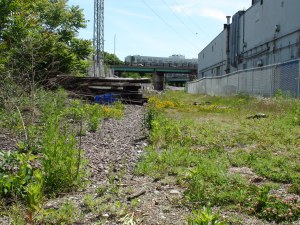 What’s left of the rail that used to run through what is now the Northern Strand, facing towards Boston and Somerville.
The other direction, unadulterated, well-paved bike path. Like a dream. This segment is pretty much all clear until you get to Malden where, near Main and Ferry St., there are a few unusual crossings you have to make to stay on the path. {: .p1}
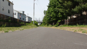 Looking north up the Northern Strand towards Malden (in Everett).
The Malden line is a little bit past Broadway, and when you get to Revere, you’re greeted by a pretty confusing sign. This photo was taken in the Summer of 2015, so it would seem the trail was open and the sign just hasn’t been removed. Either way, as far as I could see, pedestrians were ignoring it. {: .p1}
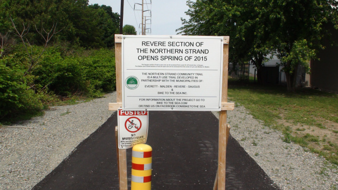 Signs may or may not indicate things which are true.
Unfortunately, this is where things get kind of messy. The trail only stayed nicely paved for so long–I was quickly greeted by a path made up almost entirely of large, rough gravel. Coming the opposite way down the path was someone riding a bike with those thick heavy-duty tires; 2 or 3 WalMart bags stuffed to the brim on either handle. It suddenly struck me that the WalMart was several miles away in Saugus, and that while I wasn’t equipped with all terrain tires, it was promising to see someone had made it as far coming the other direction. {: .p1}
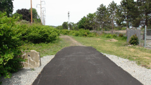 Where the sidewalk/biketrail ends.
However, some of the next segments were nearly unrideable–and going at even a somewhat brisk speed over some of the rutty terrain had me almost crash into a couple, who were casually walking, probably in their mid-50s. {: .p1}
After I came to an abrupt, accidental stop as I tried to swerve away from them, the stouter of the two belted, “How do you like this trail?” Embarrassed at my near collision, I tried to save face, “Well, I was probably going a bit too fast for it… but these rocks are a bit rough.” I backed myself out of a divot in the dirt. {: .p1}
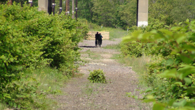 The trail is beautiful, and rugged, like a thing in a poem that is also beautiful and rugged
In the way that people who spend a significant amount of time together do, they spoke in unison with only slight variation. “We know! It’s not even nice to walk on!” {: .p1}
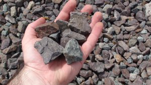 The jagged, shitty gravel in question
Determined to make it further, I bid farewell to my flabbergasted friends and pressed on. {: .p1}
I came to an overpass that had been cleaned up by Bike to the Sea, the organization behind the trail creation. Unfortunately, they also painted over the graffiti. {: .p1}
 Under the bridge downtown,
Is where I rode my bike
– Red Hot Chipotle Peppers
Under the bridge downtown,
Is where I rode my bike
– Red Hot Chipotle Peppers
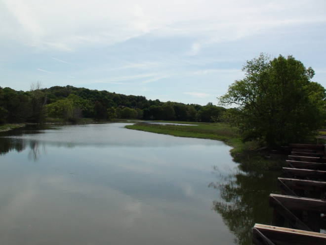
Lazily evasive mosquitos buzzed nearby a gulch which was feeding out from adjacent Rumney (not Romney) Marsh. I took a second to get out of the heat and rehydrate while I collected myself. {: .p1}
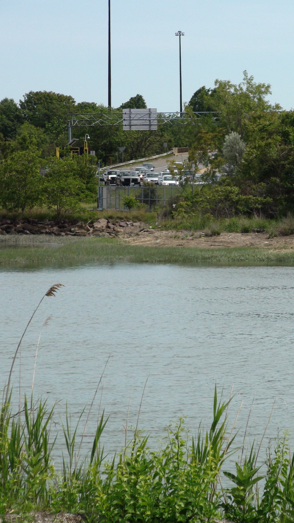 Revere, MA — One of many North Shore highways which prevent easy cross-city pedestrian routes, Rumney Marsh in foreground.
All things considered, the Revere section is not very long, albeit arduous. I was soon granted respite upon arriving at the Saugus portion of the trail, an unremarkable apartment stood by. Once again, the city line had rendered the trail somewhat uninviting, but this gravel mixture was much finer — and I could see, not a half-mile off, a wooded and shaded area looking a bit like The Shire. {: .p1}
After the overbearing heat and jagged gravel in Revere, the Saugus section seemed almost pastoral. The path abuts several rows of adjoining suburban backyards, the smell of barbecues waft and the sounds of high school sports games trickle through the trees. There were more riders on this section — even someone courageously cycling with one hand loosely gripping the leash of a golden retriever who trotted along. {: .p1}
 The flora on the Saugus section of Northern Strand
The Saugus section finally makes way through another largely marshy area where, after crossing a recently constructed bridge on the path, a local family pointed out an osprey nest on a telephone pole, which they had been watching over successive weeks. {: .p1}
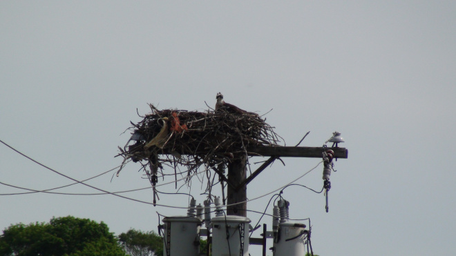 Osprey mama. Hard to tell, but it looks like it maybe collected a red feather boa and an oxen horn?
I spoke for a moment with them and told them I meant to go onwards toward Lynn. {: .p1}
“Lynn isn’t done.” the grandfather interjected, plainly. {: .p1}
“Oh, well, I’ll probably still check it out.” I said. “Do you happen to know why?” {: .p1}
“Politics”, he replied, without ceremony. {: .p1}
There wasn’t much to say after that. I moved on, crossing once again into a more urbanized area and into Lynn, where a group of fishermen had collected up against one of the less shallow ponds. This section of the trail still had its rails, which was the first indication (besides the corridor-like nature of the path) of its former usage. I had to carry my bike over a very narrow bridge though I suspect if you were going quickly enough you might be able to make it over… though I can’t say I recommend that. {: .p1}
 Saugus, nearing Lynn.
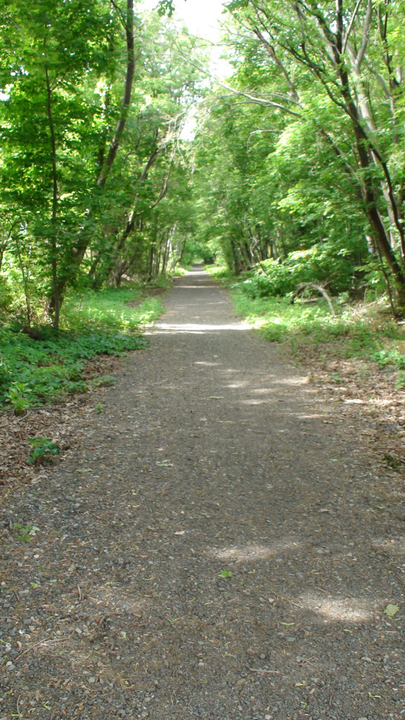
I was surprised to find, in Lynn, the trail yet to be annexed by Bike to The Sea, people were apparently already using the abandoned rail as a de facto public path for getting around the area, despite that it was evidently largely unmaintained by the city. The grass had at the very least been mowed in the past two weeks, and though plenty of detritus and trash littered the trail, a walking/cycling “desire path” had been cut deep through it, a slightly winding and slowly formed public utility. The human-tamped pathway was nearly as hard as concrete, meaning I was able to resume cycling at a normal speed and comfort level. {: .p1}
 Some people say I’m an armchair city planner. I’m told its only slightly better than a backseat driver.
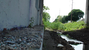
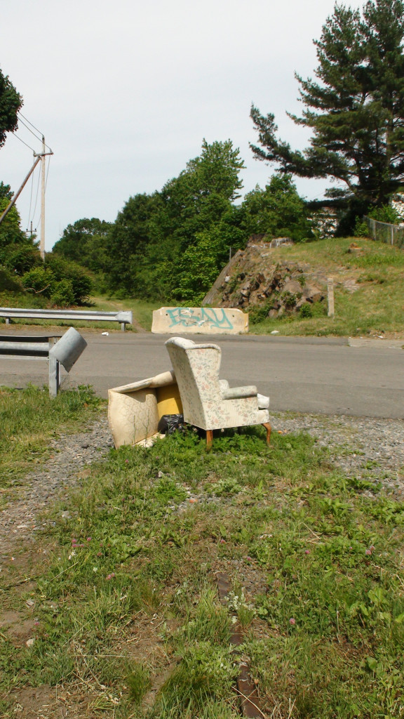
The cement blocks which cordoned off each subsequent intersection of the former railway from the roads it crossed were crumbling and decorated with local tags. Even through this disrepair some beauty shone through. Wildflowers sprouted up amongst the discarded styrofoam, rich green grasses brushed my ankles in cool wooded tunnels of overgrowth. It was obvious to me to from my the first few minutes that this was already a pedestrian highway–no assembly required. Someone basking in the shade of an oak shouted “Que pasá!”, out of breath, I could only belt back “Hola!”. Another cyclist, oncoming, showed etiquette by yielding early. In some ways, the last, undeveloped region of the trail was livelier than the whole middle. {: .p1}
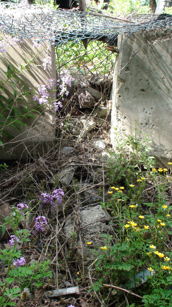 If you think trash and debris are pretty, this is for you.
Eventually, this section of the railway heads off through an abandoned industrial yard, then after crossing an elevated bridge, conjoins with active railroad, passing under a chain-link fence, which signaled the end of the trip for me. If, evidently, the trail will push on through Lynn and on to Natant beach, there will likely need to be more consistency along the path, though I’m wont to repeat the oft-echoed phrase, “It’s better than nothing.” Even then, with the natural reuse of the railway in Lynn as evidence, “nothing” is, actually, still something. {: .p1}
Here’s the catch–most would agree that anything that can be built for pedestrians is worthwhile (amongst all the barriers, walls and fences of the “concrete jungle”). Likewise, the City of Boston/MBTA could reasonably expect a return if investing capital into paths leading in to the city, namely by decreasing pollution and the intensity of traffic. However, it’s more likely that the funds will come from private donors or those cities on the trail themselves. In Lynn’s case that could mean no official trail for a long time. {: .p1}
The question is why, though? Bike paths are cheap. Everyone in the region should see the possibilities here. Taking vehicles off the road in extremely congested Greater Boston, alone, is a benefit that makes it worthwhile. Beyond that, it would go a long way to boost the economies, the happiness and the health of the citizens of these cities, where people are walled in by highways and other infrastructure meant for cars. While the marketing, “Bike to the Sea”, in of itself, is compelling to those living downtown, I’m sure the citizens of Lynn, Saugus and Revere would find “Bike to Boston” valuable as well. One could also bike to any of the several hundred small businesses, restaurants, parks or natural attractions along the path. Hell, “Bike to work” or “Bike to grandma’s house” would be valuable enough to most. {: .p1}
Chances are, most people just doesn’t know that these trails are even an option on the table. Raising the possibility of the completion of a consistent, bikeable path must come not from just raising the funds, whether private or public, but raising public awareness as well. The benefits are not just economic–for some, this is a conduit to a connection with nature that would otherwise go overlooked. Having a relationship with nature–even a tenuous one–has been shown to have immensely positive effects on people. {: .p1}
When I first discovered the trail, it was in Malden, where I was thrilled to see a community garden had sprung up as a happy side effect of the railway being converted to public use. Even without the same resources or a responsive city council, the walkers and cyclists of Lynn continue to carve their own trail, and all the while their gardens grow up from alongside the tracks, too. {: .p1}
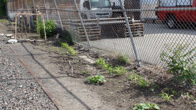 Community garden in Lynn, MA, alongside the future Northern Strand trail.